Geotechnical investigation in Corona, California, forms the essential foundation for safe and durable construction across this dynamic region. This category encompasses a suite of subsurface exploration techniques designed to characterize soil, rock, and groundwater conditions before any significant structure is erected. In Corona, where development spans from residential hillside lots to major commercial corridors along the I-15, understanding what lies beneath the surface is not merely a regulatory checkbox—it is a critical risk management tool. The process informs foundation design, earthwork specifications, and seismic safety measures, directly influencing project cost, longevity, and public safety. Comprehensive site investigation helps engineers anticipate challenges such as expansive soils, shallow bedrock, or liquefaction potential, all of which are present in the varied terrain of western Riverside County.
The local geology of Corona presents a complex tapestry that demands thorough investigation. The city straddles the boundary between the Peninsular Ranges and the Perris Block, underlain by Cretaceous granitic rocks of the Southern California Batholith, which are often weathered into decomposed granite. Overlying these basement rocks are Pleistocene-aged alluvial fan deposits from the Santa Ana River and its tributaries, creating stratified layers of sands, silts, and gravels. These younger sediments can exhibit significant variability over short distances, a condition that makes targeted in-situ testing indispensable. Of particular concern in the foothill areas, such as those near the Cleveland National Forest, are ancient landslides and colluvial deposits that require careful evaluation to ensure slope stability for hillside construction.
Regulatory compliance for geotechnical investigations in Corona is governed primarily by the California Building Code (CBC), specifically Chapter 18 on Soils and Foundations, which adopts and amends the International Building Code for local seismic and geological conditions. The City of Corona’s Municipal Code and Public Works Department enforce additional standards, including requirements for grading permits and soil reports for most new construction and significant additions. Investigations must address seismic design categories determined by proximity to active faults like the Elsinore and San Jacinto fault zones. Reports are required to include a site characterization with sufficient borings or test pits, laboratory testing to determine engineering properties, and specific recommendations for foundation type, bearing capacity, and lateral earth pressures. These documents must be prepared under the responsible charge of a California-licensed Civil Engineer or Certified Engineering Geologist.
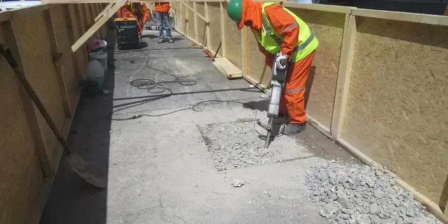
A wide array of project types in Corona necessitates a robust geotechnical investigation. Custom home builders on the slopes of Eagle Glen or in the rural areas of Temescal Valley rely on these studies to navigate challenging terrain. Commercial developers planning retail centers along McKinley Street or industrial warehouses in the Magnolia Avenue corridor require deep foundation recommendations often derived from Standard Penetration Test data. Infrastructure projects, including roadway widenings and stormwater detention basins, use continuous profiling methods like the Cone Penetration Test to map subsurface stratigraphy efficiently. For projects where near-surface conditions are particularly complex, or for forensic analysis of existing structures, direct observation via an Exploratory Test Pit provides invaluable visual data on soil structure and groundwater seepage, guiding remediation or design decisions.
Quick answers
When is a geotechnical investigation required for a project in Corona, California?
A geotechnical investigation is typically required for most new construction, significant additions, and grading projects within the City of Corona. The California Building Code and local municipal ordinances mandate a soil report prepared by a licensed engineer for any structure requiring a building permit, with particular emphasis on sites within mapped seismic hazard zones or areas with known expansive or unstable soils.
What are the primary geological hazards a geotechnical investigation addresses in the Corona area?
Investigations in Corona focus on hazards including seismic shaking and potential surface rupture from the nearby Elsinore and San Jacinto faults, liquefaction in saturated alluvial deposits, expansive soils that can damage foundations, and slope instability in hillside areas. The report evaluates these risks and provides design parameters to mitigate them according to California Building Code standards.
How deep do typical geotechnical borings or test pits go for a standard commercial building in Corona?
The depth of exploration depends on the structure's size and foundation loads, but for a typical commercial building, borings often extend 30 to 50 feet below grade, or until they penetrate competent bedrock. The specific depth is determined by the need to characterize all soil layers that could influence settlement or bearing capacity, and to assess groundwater conditions.
What is the difference between a soil report and a geotechnical investigation?
A geotechnical investigation is the complete process of field exploration, laboratory testing, and engineering analysis. The soil report, often called a Geotechnical Engineering Report, is the final document produced from this investigation. It summarizes the findings, presents the subsurface profile, and provides specific recommendations for foundation design, grading, and construction considerations for the project.